 In the course of my earliest seasons of youthful sailing exuberance, I cruised the coast in a 17-foot O’Day Daysailer. Then in my early 20s, I can still recall the dismissive reaction of one of my more experienced sailing friends to the concept of sailing anywhere offshore in an open boat: just plain foolish.
He had had the advantage of growing up in a prestigious sailing family, and had learned the ropes at the finest East Coast yacht clubs. But I am largely self-taught, and this first sailboat provided the perfect platform on which I could learn important lessons the hard way with what I hoped would be the least risk of permanent or expensive consequences.
Without access to a mooring, in the first few weeks after purchase of the boat I would launch and haul out both Saturday and Sunday, stepping and unstepping the 25-foot mast at the ramp by hand, and mostly alone each time. I’ll never forget the kindness of Frank Frisbee at Kittery Point who, after witnessing this pattern for a number of successive weekends, offered me a mooring in Pepperell Cove to use for the duration of the season (this in the less formal days before 20-year waiting lists and port authority oversight). Frank told me that anyone who would go through what I did every weekend to sail a little boat around in the river deserved a regular spot in the harbor.
The boat had a covered foredeck that provided a modicum of shelter and broke the biggest oncoming waves. The cockpit had no scuppers, but could be bailed with a big bucket in a few minutes. The mainsail was easily reefed and the jib was small. I quickly learned to avoid capsizing and to make her go to windward. Weekend afternoons were spent committing a spectrum of nautical errors. Evenings were spent reading about how to avoid some of the next ones.
As experience and courage increased, we began to travel farther afield, and to spend nights aboard. A canvas boom tent created sleeping space for two, but with my cruising companion’s propensity to seasickness, nights with any swell were often spent in the open, and sometimes in the rain. We cooked on a gasoline-fueled backpacking stove and had a bucket for a head. Such was my introduction to coastal cruising.
At the end of a weeklong cruise to Casco Bay, somewhere around 1980, my friend and I left Kennebunkport one morning headed for the Piscataqua. A hurricane was passing well offshore. The storm had stirred up some great rolling swells, and a dry nor’easter was blowing steadily. We had all day to sail, and a direct course home along the shore would have had us in the harbor shortly after lunch.
As every sailor knows, a reach is more fun than a run, and we had plenty of time. So we decided to make a big loop around the Isles of Shoals, and go home via two long reaches to take advantage of the steady wind and exhilarating sailing conditions.
With the haze just thick enough to shroud out the offshore landmark of Boon Island, and with the only chart we had cutting off before the Isles of Shoals, I committed another of my critical nautical errors: I simply guessed the course to Appledore Island, and proceeded to follow the bobbing little compass – screwed to the centerboard trunk – a bit east of south and out beyond the sight of land. The correct course would have been about 30 degrees to the west of magnetic south.
We sailed in blissful abandon well past noon, the long smooth swells rolling by in a parade of hills and valleys. The wind held steady from the northeast, and the little boat nearly planed along joyfully. The wave troughs were so deep that, in the valleys, there was no horizon, only smooth walls of rolling ocean all around. A small circle of hazy blue sky on top sported gray clouds streaming by to the southwest. The visibility was a few miles or more, but even in our brief moments at the top of the swells, we saw no other vessels or navigation aids.
By early afternoon we judged ourselves to be well beyond Boon and began scanning beyond the wave tops for a sighting of Appledore Island, which, considering a steady speed of five to six knots and a distance of less than thirty miles or so, should have been coming into view at any time. All of this data, including the course to steer, was never more than a vague approximation. But man, were we sailing!
Sometime around 1500 – about the same time that a hint of long overdue concern was just beginning to be recognized between us – we rose to the top of a particularly big swell and sighted a tower about in the direction where we guessed Appledore should have been, with a bearing of about 170 degrees. Appledore at last! Soon we’d be able to turn northwest and reach back on the other tack for Kittery Point and a triumphant arrival home.
Relieved, we surfed happily down the big wave’s face and back into the troughs.
It was a few minutes before we rose to the top of another swell that was tall enough to afford the same long view. When we did, despite having held a steady course in the meantime, the “Appledore tower” was now bearing about 120 degrees. The tower was clearly not on an island at all, but on a ship steaming somewhere out to sea.
The realization slowly came over us that we had no idea at all where we were, except that we knew for certain that we were very far out. The day’s earlier joy quickly faded to dread, and my privileged friend’s words about the foolishness of going to sea in an open boat echoed in my head. But still, the little boat streamed happily along, shipping no water and behaving as though she belonged there.
In those early days, before navigation skills evolved, my accepted cruising practice when our position was in considerable doubt was simple and usually effective: Heed the words of that great American optimist, Horace Greeley. And so, west we turned, and westward we continued to reach, back toward America for two hours and more, sighting neither vessel nor island all the while.
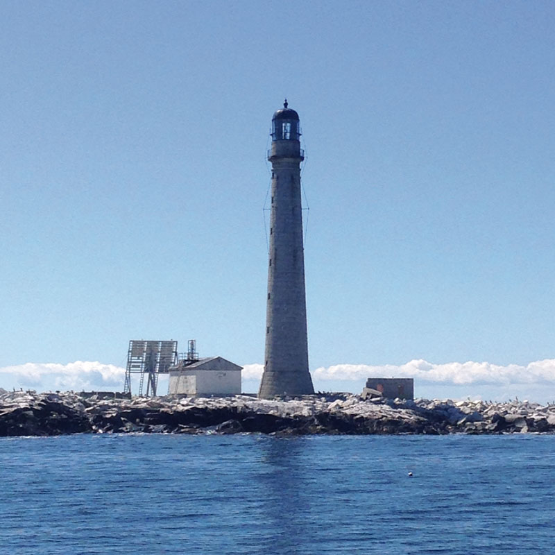
In the very late afternoon we finally sighted the actual, unmoving radar tower on Appledore Island. Leaving Duck Island and its well-remembered ledges to Port, we headed northwest and continued reaching along, gaining the mouth of the Piscataqua as the sun was going down.
Foolish adventure? I’ll let you be the judge. I just know that I can still feel the thrill of steering that little boat in those great friendly swells over 35 years ago. And, yes, I have sailed with a complete library of charts ever since.


 We have complete issues archived to 2009. You can read them for free by following this link.